-
Hey, guest user. Hope you're enjoying NeoGAF! Have you considered registering for an account? Come join us and add your take to the daily discourse.
You are using an out of date browser. It may not display this or other websites correctly.
You should upgrade or use an alternative browser.
You should upgrade or use an alternative browser.
Hurricane Season 2010: Getting a jump on June 1st
- Thread starter Xeke
- Start date
- Status
- Not open for further replies.
perfectchaos007
Member
Atlantic Graphical TWO Area 1 closeup
--------------------------------------------------------------------------------
Return to Atlantic Graphical TWO
1. DATA FROM AN AIR FORCE RECONNAISSANCE PLANE INVESTIGATING THE AREA
OF LOW PRESSURE IN THE SOUTHWESTERN CARIBBEAN SEA INDICATE THAT A
TROPICAL DEPRESSION HAS FORMED. THE NATIONAL HURRICANE CENTER WILL
ISSUE A SPECIAL ADVISORY AT 2 PM EDT TODAY. THERE IS A HIGH
CHANCE...100 PERCENT...OF THIS SYSTEM BECOMING A TROPICAL CYCLONE
DURING THE NEXT 48 HOURS.
perfectchaos007
Member
Relix said:Matthew is gonna be taking aim at S.FL. Could be the first true system to impact USA this season. And it doesn't have good intentions at all.
why south florida? thats an oddly specific destination for a storm that looks like it could go just about anywhere. hell it may stall over the yucatan and just die completely.
perfectchaos007
Member
well it made landfall way earlier than expected. Theres even a chance it could just cross over from the Atlantic to the Pacific. I didn't know that was possible!
edit: looks like it's projected to die out over the next three days over land
edit: looks like it's projected to die out over the next three days over land
perfectchaos007 said:well it made landfall way earlier than expected. Theres even a chance it could just cross over from the Atlantic to the Pacific. I didn't know that was possible!
edit: looks like it's projected to die out over the next three days over land
Lol initial models claimed it to go to SFL. I honestly didn't check it out much and just followed NHC's guidance :lol :lol GFS is going crazy with low pressures in the Caribbean, we might see a few things pop up. And on the WTF AMAZING list of things this season, Lisa became a fucking Hurricane. Damn =P
000
WTNT34 KNHC 242256
TCPAT4
BULLETIN
HURRICANE LISA SPECIAL ADVISORY NUMBER 17
NWS TPC/NATIONAL HURRICANE CENTER MIAMI FL AL142010
700 PM AST FRI SEP 24 2010
...LISA RAPIDLY STRENGTHENS INTO THE SEVENTH HURRICANE OF THE
SEASON...
SUMMARY OF 700 PM AST...2300 UTC...INFORMATION
----------------------------------------------
LOCATION...20.2N 27.8W
ABOUT 385 MI...615 KM NW OF THE CAPE VERDE ISLANDS
MAXIMUM SUSTAINED WINDS...75 MPH...120 KM/HR
PRESENT MOVEMENT...N OR 360 DEGREES AT 8 MPH...13 KM/HR
MINIMUM CENTRAL PRESSURE...989 MB...29.21 INCHES
WATCHES AND WARNINGS
--------------------
THERE ARE NO COASTAL WATCHES OR WARNINGS IN EFFECT.
DISCUSSION AND 48-HOUR OUTLOOK
------------------------------
AT 700 PM AST...2300 UTC...THE CENTER OF HURRICANE LISA WAS LOCATED
NEAR LATITUDE 20.2 NORTH...LONGITUDE 27.8 WEST. LISA IS MOVING
TOWARD THE NORTH NEAR 8 MPH...13 KM/HR. THIS GENERAL MOTION IS
FORECAST TO CONTINUE THROUGH TONIGHT...WITH A TURN TOWARD THE
NORTH-NORTHWEST EXPECTED BY LATE SATURDAY.
MAXIMUM SUSTAINED WINDS HAVE INCREASED TO NEAR 75 MPH...120
KM/HR...WITH HIGHER GUSTS. LISA IS A CATEGORY ONE HURRICANE ON THE
SAFFIR-SIMPSON HURRICANE WIND SCALE. SOME STRENGTHENING IS
POSSIBLE TONIGHT AND EARLY SATURDAY WITH GRADUAL WEAKENING EXPECTED
BY SATURDAY NIGHT.
LISA IS A RATHER SMALL TROPICAL CYCLONE. HURRICANE FORCE WINDS
EXTEND OUTWARD UP TO 10 MILES...20 KM...FROM THE CENTER...AND
TROPICAL STORM FORCE WINDS EXTEND OUTWARD UP TO 45 MILES...75 KM.
THE ESTIMATED MINIMUM CENTRAL PRESSURE IS 989 MB...29.21 INCHES.
HAZARDS AFFECTING LAND
----------------------
NONE.
NEXT ADVISORY
-------------
NEXT COMPLETE ADVISORY...1100 PM AST.
$$
FORECASTER BLAKE
perfectchaos007
Member
and hasn't this system been over land for 6 hours now? The system actually has gotten stonger max winds over the past few hours. How the hell has the system gotten stronger while being over land for 6 hours!? This system continues to confuse. Maybe the center of circulation is not where they thought?
perfectchaos007 said:and hasn't this system been over land for 6 hours now? The system actually has gotten stonger max winds over the past few hours. How the hell has the system gotten stronger while being over land for 6 hours!? This system continues to confuse. Maybe the center of circulation is not where they thought?
Fay did the same over Florida =P. I remember reading HH finding the lowest pressure north of the forecast center, but I really haven't been following Matthew much at all so don't count on that info. Its possible warm waters to the north are feeding him a bit.
perfectchaos007
Member
Relix said:Fay did the same over Florida =P. I remember reading HH finding the lowest pressure north of the forecast center, but I really haven't been following Matthew much at all so don't count on that info. Its possible warm waters to the north are feeding him a bit.
well according to the GFS models it's still going to eventually travel back toward Florida so you may want to track it again.
But anyway it's 2am and the pressure is STILL 998 millibars just like it was 15 hours ago, and it has been over land for 15 hours. Winds are also still at 50 mph. Land weakens hurricanes is a myth confirmed!!!! ;p
Storms don't give a shit what the NHC thinks :lol :lol It seems the center is drifting a bit to the north and moving slowly, which will give it some additional time over water. The worst thing about Matthew will be the constant deluge over C. America. A never ending pipe of water for them there.
That Low you mention over Florida is actually a second low most models are spinning FROM Matthew. They expect the system to die and leave another low behind, that's what forms and hits Cuba and Florida, and the scary thing is there's practically unanimous consensus between the models for this to happen. GFS is extremely bullish though, and is having multiple lows in the carribbean, Fujiwara interactions, merging lows, etc. The ITCZ is expected to lift over the Caribbean so there will be limitless energy/moisture there, so anything will a low pressure will definitely gain something, maybe not a cyclone, but a big heavy event for all the islands, Central America, and definitely storm and hurricanes for the USA.
Cape Verde closed shop. Maybe a wave will sneak by but for now no tracking needed. Now comes the worst part for the US it seems.
Some interesting hurricane factoids compiled by Adam Lea, of University College London for this year:
1. Since 1900 there is no precedent of an Atlantic hurricane season with 10 or more hurricanes where none has struck the US as a hurricane. The five previous seasons with 10 or more hurricanes each had at least two hurricane strikes on the US.
2. The last precedent for a La Nina year of the magnitude of 2010 which had no US-landfalling hurricane is 1973.
3. Since hurricane Ike (2008) there have been 16 consecutive non US-landfalling hurricanes. Such a sequence last happened between Irene (1999) and Lili (2002) with 22 consecutive non US-landfalling hurricanes, and between Allen (1980) and Alicia (1983) with 17 consecutive non US-landfalling hurricanes.
4. The period 2006-2010 is one of only three 5-year consecutive periods without a US major hurricane landfall (the other two such periods were 1901-1905 and 1936-1940). There has never been a six year period without a US major hurricane landfall.
5. Historically one in four Atlantic hurricanes strike the US as a hurricane. Thus the recent dearth in strikes should be corrected in the next few years.
Relix said:Two storms and November about top start. I am sure we can call this a hyperactive season already =P
Tomas looks potentially deadly.


Dead Prince
Banned
Tomas? WTF. i didn't think we made it this far this season :lol
DMPrince said:Tomas? WTF. i didn't think we made it this far this season :lol
It's the 5th most active Atlantic season in history so far.
jamesinclair
Banned
The fuck is Tomas doing so south?
Is Grenada getting a direct hit? Half their buildings still lack roofs from the last one (a few years ago)
Is Grenada getting a direct hit? Half their buildings still lack roofs from the last one (a few years ago)
Smiles and Cries
Member
how come this thread died when a hurricane laid the smack down on St. Lucia and now headed to Haiti today?
Smiles and Cries said:how come this thread died when a hurricane laid the smack down on St. Lucia and now headed to Haiti today?
lol
I dunno, I stopped keeping track.

jamesinclair
Banned
Smiles and Cries said:how come this thread died when a hurricane laid the smack down on St. Lucia and now headed to Haiti today?
Thread popularity check:
Is there an active hurricane? + 3 replies
If:
Is it aimed at the USA? + 47 replies
or
Is it not aimed at the USA? -2 replies
or
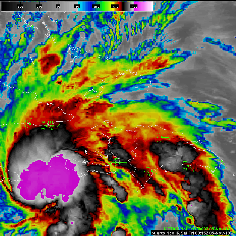
Is it aimed at Puerto Rico? + 1 reply
Total = 3 +/1 the 2nd portion of the equation

perfectchaos007
Member
Well today is the last day of hurricane season 2010. Another overhyped hurricane season that never quite panned out.
perfectchaos007 said:Well today is the last day of hurricane season 2010. Another overhyped hurricane season that never quite panned out.
It been very active in the Atlantic. Just nothing reached landfall on the mainland.
I believe I read the Pacific had an all-time low for activity. It's kind of interesting the apparent ying-yang effect of the two oceans.
- Status
- Not open for further replies.