speculawyer
Member
Uh oh.
I hope there is not too much damage. :-/
I'm out for work so I won't be updating the OP in the next few hours.
Current USGS info:
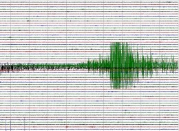
Magnitude 7.6 - OAXACA, MEXICO
2012 March 20 18:02:48 UTC
Details
Maps
Tsunami
Earthquake Details
This event has been reviewed by a seismologist.
Magnitude
7.6
Date-Time
Tuesday, March 20, 2012 at 18:02:48 UTC
Tuesday, March 20, 2012 at 12:02:48 PM at epicenter
Location
16.662°N, 98.188°W
Depth
17.5 km (10.9 miles)
Region
OAXACA, MEXICO
Distances
25 km (15 miles) E (95°) from Ometepec, Guerrero, Mexico
42 km (26 miles) NNW (335°) from Pinotepa Nacional, Oaxaca, Mexico
87 km (54 miles) SW (219°) from Tlaxiaco, Oaxaca, Mexico
162 km (101 miles) WSW (255°) from Oaxaca, Oaxaca, Mexico
186 km (115 miles) E (96°) from Acapulco, Guerrero, Mexico
Location Uncertainty
horizontal +/- 15.8 km (9.8 miles); depth +/- 6.5 km (4.0 miles)
Parameters
NST=438, Nph=440, Dmin=312.8 km, Rmss=0.88 sec, Gp= 79°,
M-type=regional moment magnitude (Mw), Version=9
Source
Magnitude: USGS NEIC (WDCS-D)
Location: USGS NEIC (WDCS-D)
Event ID
usc0008m6h
http://earthquake.usgs.gov/earthquakes/recenteqsww/Quakes/usc0008m6h.php
I hope there is not too much damage. :-/
I'm out for work so I won't be updating the OP in the next few hours.
MEXICO CITY (Reuters) - A major 7.6 magnitude earthquake struck 120 miles east of Acapulco on Mexico's Pacific coast, the U.S. Geological Survey said on Tuesday.
The USGS located the epicenter of the quake at 15 miles east of Ometepec in Guerrero state at a depth of 10.9 miles.
The Pacific Tsunami Warning Center said the inland earthquake would not generate a destructive widespread tsunami, but there was the possibility of some local tsunami effects.
The quake was felt in Mexico City where buildings shook and office employees fled into the street, according to a Reuters witnesses. Cell phone lines were down and traffic snarled in the capital moments after the quake.
No damage was reported in Oaxaca, near where the quake hit, according to local television.
Earlier it had been reported at 7.9 magnitude and initially as 7.6 magnitude.
Current USGS info:
Magnitude 7.6 - OAXACA, MEXICO
2012 March 20 18:02:48 UTC
Details
Maps
Tsunami
Earthquake Details
This event has been reviewed by a seismologist.
Magnitude
7.6
Date-Time
Tuesday, March 20, 2012 at 18:02:48 UTC
Tuesday, March 20, 2012 at 12:02:48 PM at epicenter
Location
16.662°N, 98.188°W
Depth
17.5 km (10.9 miles)
Region
OAXACA, MEXICO
Distances
25 km (15 miles) E (95°) from Ometepec, Guerrero, Mexico
42 km (26 miles) NNW (335°) from Pinotepa Nacional, Oaxaca, Mexico
87 km (54 miles) SW (219°) from Tlaxiaco, Oaxaca, Mexico
162 km (101 miles) WSW (255°) from Oaxaca, Oaxaca, Mexico
186 km (115 miles) E (96°) from Acapulco, Guerrero, Mexico
Location Uncertainty
horizontal +/- 15.8 km (9.8 miles); depth +/- 6.5 km (4.0 miles)
Parameters
NST=438, Nph=440, Dmin=312.8 km, Rmss=0.88 sec, Gp= 79°,
M-type=regional moment magnitude (Mw), Version=9
Source
Magnitude: USGS NEIC (WDCS-D)
Location: USGS NEIC (WDCS-D)
Event ID
usc0008m6h
http://earthquake.usgs.gov/earthquakes/recenteqsww/Quakes/usc0008m6h.php